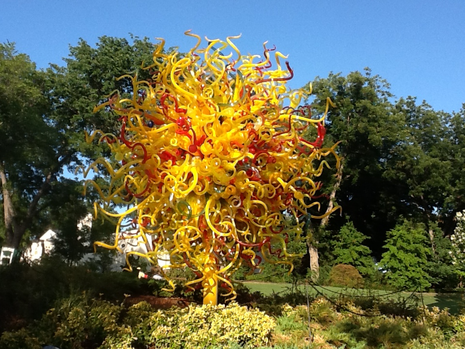
IMG_0521.JPG
One of the glass pieces
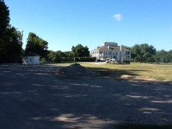
IMG_0605.JPG
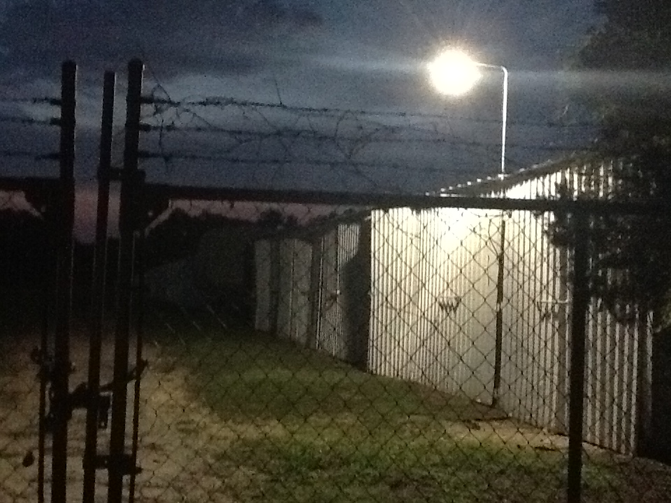
There was a campground behind this stately
mansion allegedly helping financing it. |
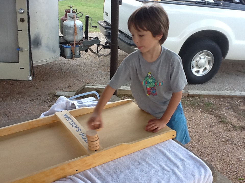
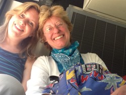
| After three days of admittedly somewhat half-hearted driving we are
still in Texas :-). It's a big state and we drive its largest diameter from the gulf to the panhandle.
|
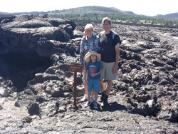
IMG_0651.JPG
View from the Capulin Volcano Crater rim, New Mexico |
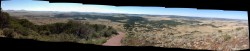
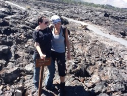
IMG_0662_stitch.jpg
A panorama shot from the rim |
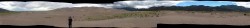
IMG_0724_stitch.jpg
A panorama of the Great Sanddunes in Colorado |
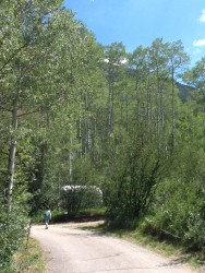
| A few photos of Independence Pass in the Rockies. It's part of the continental
divide. The pass is one gateway to Aspen,
but it's only open in summer, and not
for long vehicles. But as usual our little Airstream can go anywhere our truck goes, and the truck
doesn't really count as big here.
|
IMG_0808_stitch.jpg |
IMG_0831.JPG |
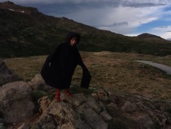
IMG_0840.JPG |
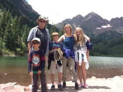
July 22 - July 26
We have spent some days with Leslie and George and their children in Aspen, Colorado. Aspen is the St. Moritz of the Rockies. It's beautifully located at an altitude of 8000 feet (2500m), surrounded by some of the highest peaks of the Rocky Mountains. In winter there is always tons of snow. In the summer the air is fresh and everything invites you to go on a hike or a bike trip on the nicely prepared trails. Real estate is extremely expensive; everybody seems to be rich. There seems to be a competition going on among the women who is the most sporty. Slender bodies, no matter whether they are 30, 40 or 50. It's really conspicuous. Their main occupation must be working out. Perhaps being a trophy wife is a precarious position that doesn't become more comfortable as time passes. The men are well dressed in an expensive casual fashion and are mostly good looking and in good shape as well. They are often on their phones talking business, but not so much that it would be really annoying. People tend to be friendly and open. A couple of times people who overheard our conversation offered advice from the next table in the cafe. |
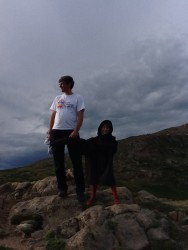
IMG_0864.JPG |
IMG_0891.JPG |
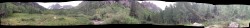
A panorama at the foot of the Maroon Bells |
|
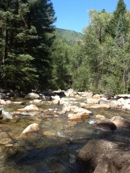
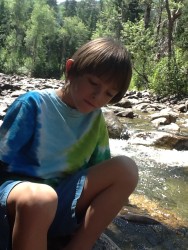
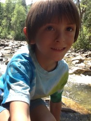
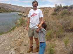
The river was great. Robin and I crossed it hopping from rock to rock,
together with Lily and Thomas. Sometimes
Robin would jump and hold on to my hands while I would swing him around to the next rock,
balancing myself. Quite exciting. I had a little freak accident there: A big rock that may well
have weighed half a ton
gave under my weight (now is the time to start your diet, right?). Turned out it split
straight in two. Thank goodness noobody was close to it. I landed on my soft behinds
and got away with just a few bruises. That was lucky although some sitting positions still
feel uncomfortable ;-).
Later we learned that the rocks are generally very unstable and accidents involving rock
climbers are uncomfortably common. |
|
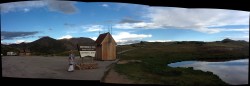
IMG_1002.JPG |
IMG_1003.JPG |
Our picturesque camp site. Attention check: What trees are these? |
| The route would take us through Utah and Idaho. We didn't want
to make big detours but still picked a few attractions on the way. One of them was
the Dinosaur National Monument. |
IMG_1045_stitch.jpg |
July 28
In the morning we explored the Dinosaur Quarry National Moument.
The display of the dinosaur bones in the quarry
is of course, well, monumental.
There is a photo of the paleontologist who discovered
the bones in the 1930s. Wanna see a happy man? ;-)

The campground of the monument is nicely located
next to a river, with
shady spots, crucial at this time of year. As always
after some time in the desert one appreciates water
and looks for green specks on the horizon which may indicate some.
Camping in a lush valley is like nature's blessing to the traveler.
This place is well worth returning. We would have liked
to stay longer and explore some of the monument's mountainous
backcountry.
We did take the time to explore some easily accessible
parts of the monument though. An auto route leads to
some of the petroglyphs
(drawings scratched into the rock, as opposed to rock paintings
with colors). They are about as old as our romanic medieval churches
which is kind of a funny thought. At the end of a little dirt road we took
a little hike to the remains of the
homestead of Josie Morris. In 1916, after 4 marriages,
this then 40 year old lady decided to live on her own,
built her own log cabin and lived off the land.
An enchanting place with a moving story. The efforts that have
been made to preserve some of the structures she erected
(stable, cabin, ponds) really pay off.
|
IMG_1071.JPG |
IMG_1081.JPG |
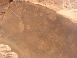
To us the face paintings were not all that mysterious: It's clearly space ships and galaxies! ;-) |
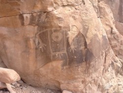
Look, a man! |
The cabin of Josie Morris |
One of the pocket canyons which Josie used to keep cattle.
There is surface water coming down from the mountains. |
IMG_1116.JPG |
Dinosaur Bingo in the exhibition hall |
IMG_1160.JPG |
|
After some afternoon driving we camped at the aptly named
River's Edge Camp Ground.
It's located at the foot of the impressive Jordanelle Dam. When I wanted
to climb it I discovered that it's all fenced off with video surveillance.
(Later the camp host said that it was accessible before 9/11.) Knowing
your stubborn author it shouldn't surprise you that I tried to get
up there anyway, although not under the eye of the video with flood
light. Instead I climbed a side mountain nearby in order to
approach the dam from the side. When I explored a concrete structure that
looked like a mine entrance I found that it was a tunnel entrance.
It looked like a water tunnel so I figured it might take me to the
dam. (No, it didn't look as if much water had flown through it recently).
Luckily I had brought a flashlight.
It was longer than I had anticipated but at the end I was not disappointed.
It was an overflow tunnel with an inlet close to the dam's
crest. Fortunately the end of the inlet was a dirt slope (or I coudn't have
escaped the high concrete walls). And there I was: No "no trespassing"
signs passed, no fences climbed — and still right on the damn dam.
Image legend: I crossed the river at the foot of the mountain at 1,
the tunnel outlet is close to 1a, inlet at the dam's crest is 2,
3 is where I ended up and 4 is probably a regular water inlet.
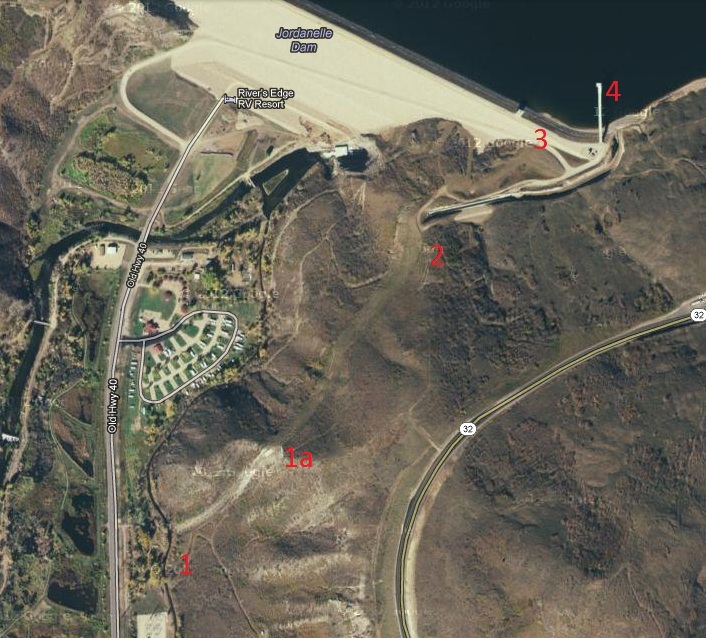
The water level was low; chances are that they need to
relocate the inlet soon, like at Lake Mead when the level
there hit historical lows.
The way back took a little longer than planned because I didn't want
to backtrack; I climbed down the mountain slope towards
the campground on deer trails, by then in the dark.
The paths down to the campground are clearly visible on the aerial picture
but were hard to find and follow on the ground in the dark. By the time
I got down Michelle was already looking for me with a flashlight.
She had worried quite a bit.
(Shouldn't she know by now? The first time I was in America with Michelle
I took a little afterooon stroll from Leslie's home in Altadena
and ended up on Mt. Wilson which is farther away
than one thinks in the clear
air. Luckily there was a phone booth at the observatory
entrance, so I called her at 8 p.m. before I hiked back.)
|
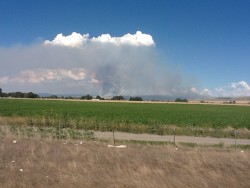
Wildfire in Idaho. The horizon looked unusually hazy from the distance,
but it was not moisture. |
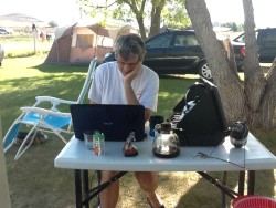
Yippee, WLAN! ;-) |
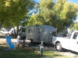
On a typical KOA campground. Well maintained, all amenities, but
densely packed as compared to public campgrounds. |
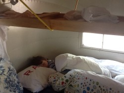
Robin asleep under the suspended shuffleboard. There was no other
way to store it. |
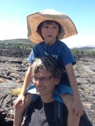
| Images from the Craters of the Moon National Monument. Amazingly, there was frozen water at the bottom of the aptly named Dewdrop Cave.
A quick search indicates that that happens in other caves, too. It is really stunning because it's very hot outside in the summer.
A brief discussion of the mechanisms can be found in Wikipedia. |
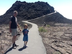
One of the lava spouts that scatter the park |
|

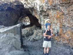
Dewdrop Cave Entrance |
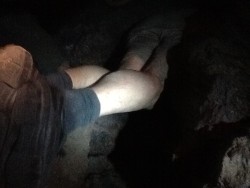
Your fearless author taking the next picture |
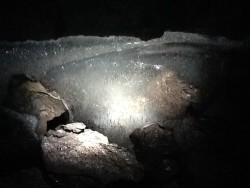
Ice! |
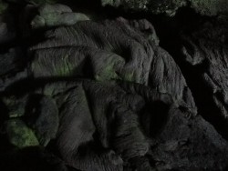
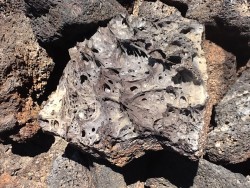
Funny folded rock shape |
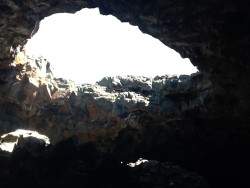
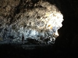
In one of the bigger caves with "skylights" |
|
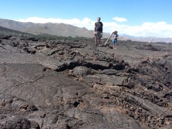
This is actually a lava tunnel (it's big — do you see me standing there?). Lava was flowing underground for miles like in large pipelines. When the supply stopped, the duct drained and the empty tunnel remained as it can be seen today. |
|
|
|
We met these two girls on the cave hike and Robin
showed them the ice. They were so excited :-). |
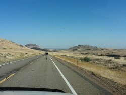
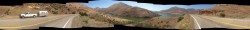
Typical road scene. Typical weather, too. |
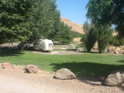
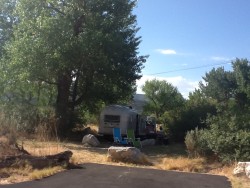
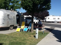
Typical camp site ;-). We took a little detour to
get to this lake campground which was totally mosquito infested at night. |
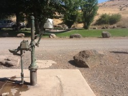
Funny old pump (only potable water source there) |
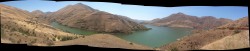
Two panorama shots of the Hell Canyon feeding into Columbia Gorge |
|
Last stop before Portland |
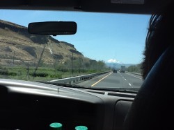
In the background is Mt. Hood. Seeing it from great distance reminds me of images of the Fujiyma or Kilimandjaro (not that I have seen either of them). |
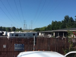
Full circle: The next storage space. |
| In Portland we were so wonderfully hosted by David and Doris
(and Devon and Daniel, too,
who made it so much fun for Robin). We felt really at home. Thank you!
If all things go all right, we have a townhouse in Portland by September 5th. |